오늘의 포스팅을 도와주신 사이트는 http://www.env.go.jp/en/nature/nps/park/index.html.
대략 30개에 이른다는 일본의 국립공원 중, 한국에서 차 끌고 가기 가장 만만한 규슈 지역에 한정해서 검색하면 아래처럼 7개.
이 중 좀 애매한 놈들을 제외하고 나면 딱 4개.
Setonaikai National Park
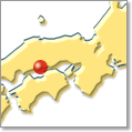
Designation: March 16, 1934
Area: 66,934 ha
Prefectures: Hyogo, Wakayama, Okayama, Hiroshima, Yamaguchi, Tokushima, Kagawa, Ehime, Fukuoka, Oita
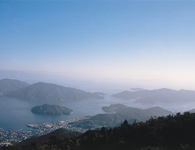
Setonaikai National Park consists of about 3,000 islets, small and large, and is famous for offering a sweeping view of huge clusters of islands floating in the calm inland sea. one such example of such beauty can be obtained in the view of the Bisan Archipelago as seen from Mt. Washu. Areas of white sandy beaches bordered by green pines, such as those found along the Shibukawa coast and in Keino-Matsubara, as well as terraced fields and other scenes of people living in a state of intimate connection with nature are signature attributes of this park.
Saikai National Park
Designation: March 16, 1955
Area: 24,646 ha
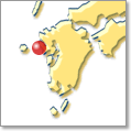
Prefecture: Nagasaki
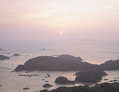
Saikai National Park consists of more than 400 islands, large and small, including Hirado, the Kujukushima ("99 Islands") Islands of Sasebo, and the Goto Archipelago. The park is famous for the myriad vistas that can be found among the Kujukushima Islands and the Wakamatsu-Seto Passage. High cliffs dot the islands in the area while Fukue Island is the site of rare volcanic formations.
Unzen-Amakusa National Park
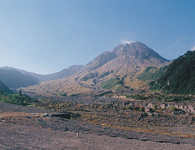
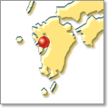
Designation: March 16, 1934
Area: 28,279 ha
Prefectures: Nagasaki, Kumamoto, Kagoshima
Unzen-Amakusa National Park consists of the area surrounding Mt. Unzen-dake in the middle of the Shimabara Peninsula and the islands of Amakusa. The Unzen area is a resort district built around Mt. Fugen-dake, which is famous for volcanic activity that occurred in 1990, and numerous local hot springs. The Amakusa area is celebrated for the beauty of its 120 islands, large and small, in the Ariake and Yatsushiro seas.
Aso-Kuju National Park
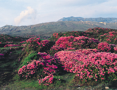
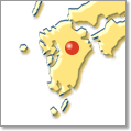
Designation: December 4, 1934
Area: 72,678 ha
Prefectures: Kumamoto, Oita
Aso-Kuju National Park is a mountainous park with many volcanoes and the world's largest caldera basin, whose circumference measures approximately 90 kilometers. The Aso area boasts a magnificent view of the Aso-Godake Mountains, grassy plains, and an active volcano in Mt. Naka-dake. The Kuju area commands spectacular vistas of the Kuju Range and Mt. Yufu-dake. The region is famous as a habitat for wild azaleas.
Kirishima-Kinkowan National Park
Designation: March 16, 2012
Area: 36,586 ha
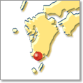
Prefectures: Miyazaki, Kagoshima
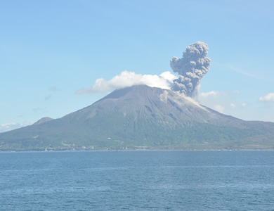
The Kirishima area comprises over twenty volcanoes, including Mt. Karakuni-dake, as well as natural forests of chinquapin, oak, Japanese red pine trees, and more situated at the foot of these mountains. Sakurajima, an active volcano, is a natural landmark of the Kinko Bay area.
yakushima National Park
Designation: March 16,2012
Area: 24,566 ha
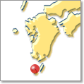
Prefectures: Kagoshima
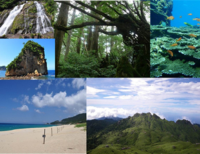
Yakushima is famous as an island habitat of Jomon-sugi, Daio-sugi, and other examples of Yaku-sugi (Japanese cedars that are over 1,000 years old).
Iriomote-Ishigaki National Park

Designation: May 15, 1972
Area: 20,569 ha
Prefecture: Okinawa
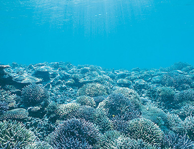
Iriomote-Ishigaki National Park consists of Iriomote Island, Ishigaki Island, other islands that punctuate the space in between these islands, and the sea. In addition to subtropical forests, the park is home to mangrove trees growing in the estuary of the Nakama River, the Nagura Anparu wetlands, and elsewhere. The Iriomote wildcat and many other rare wild animals found nowhere else call Iriomote Island home. The largest coral reef in Japan lies in the seas between Taketomi Island and Ishigaki Island.
그리고 하나 더, Kyushu Nature Trail
- Length of trail 2,587 km, 1,607 miles
- Length in days 130 days
- Traildino grading MW, Moderate walk, backpacking trail
- Hut tour grading T1, Walk
'2017(카미노+이키레몰우벨·규슈올레 > 1st 규슈 올레' 카테고리의 다른 글
| 일본 규슈 2주 일정 초안(1차안) (0) | 2012.09.10 |
|---|---|
| 고려훼리 뉴카멜리아 객실 (0) | 2012.07.05 |
| 일본 규슈로 자동차 끌고 가기 (0) | 2012.07.04 |
| [수정판] 2011 상반기 휴가계획 - 네팔/태국/일본편 (0) | 2011.02.23 |
| 2011 하계 휴가 계획 삽질 (0) | 2010.08.31 |
